In today’s fast-moving world, knowing exactly where your vehicles and assets are isn’t just convenient anymore — it’s critical. Whether you manage a fleet across cities or want reliable oversight of your cars, generators, or equipment, accurate mapping has become the foundation of modern visibility. That’s why businesses are turning to GIS-powered solutions from Tracking World to bring clarity, control, and confidence to their operations.
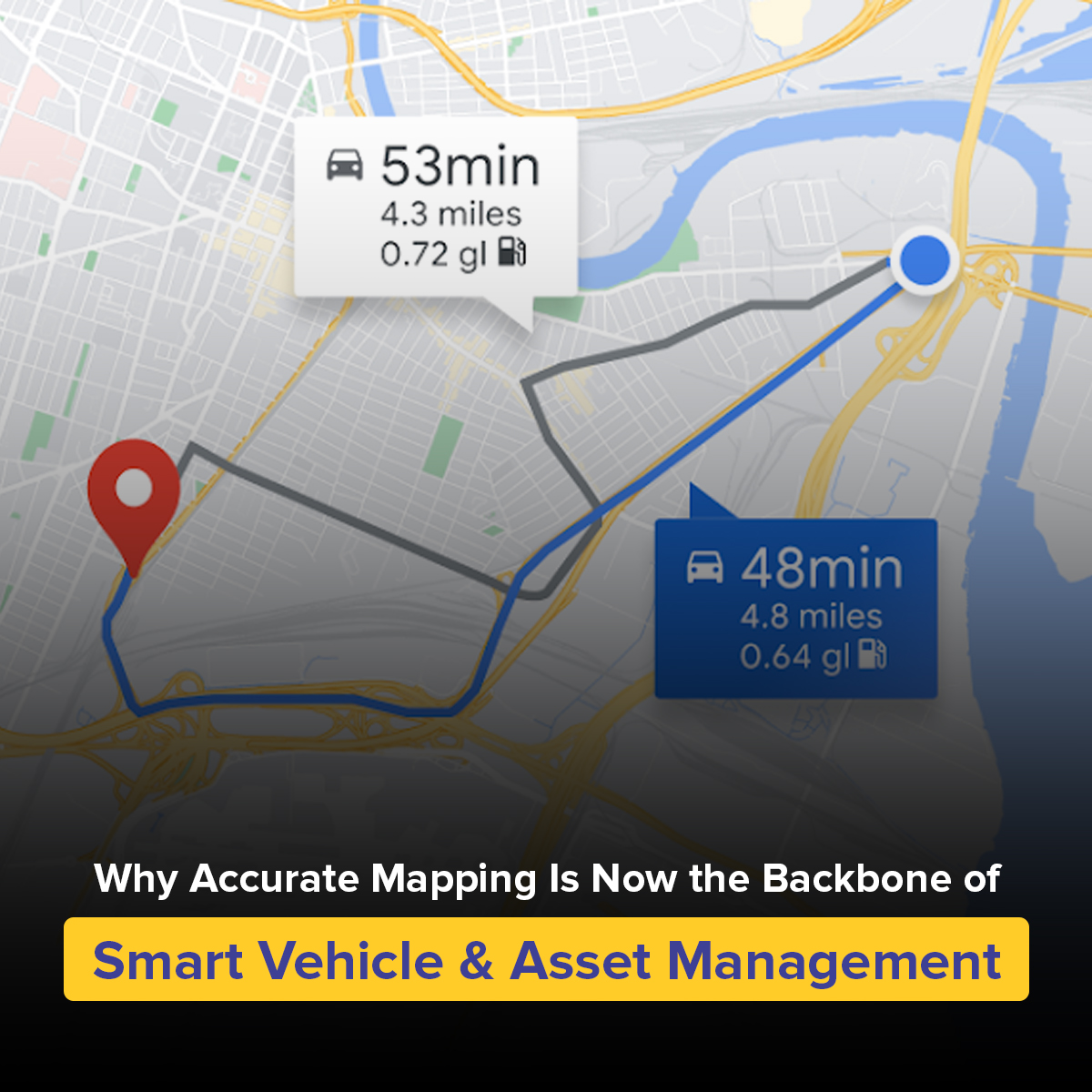
GIS isn’t just a map. It’s a powerful layer of intelligence that turns raw movement into meaningful insight. When paired with a vehicle tracking device, gps tracking system, or fleet tracking solution, GIS helps you understand how your assets move, where they perform best, and where risks lie.
With precise data, you can see everything from route patterns to terrain behavior — and make better decisions without guesswork.
Stronger Security Through Better Visibility
A reliable GIS system empowers you to monitor assets in real time, so you always know what’s happening in the field. Pairing GIS with a gps tracker, car tracking device, or vehicle gps tracker ensures:
- Instant alerts when assets leave designated areas
- Accurate location recovery in case of theft
- Clear travel history for audits and analysis
For businesses, this level of transparency reduces uncertainty and increases accountability — something traditional maps simply can’t match.
Smarter Routing, Lower Fuel Costs
GIS-driven routing helps companies cut major operational expenses. With fleet gps tracking and smart map data, managers can plan routes that avoid congestion, shorten travel time, and reduce fuel waste. The result? More efficient operations and happier customers.
Even small businesses see big benefits when they add gps location tracking to their workflow.
Better Decisions with Clean, Reliable Data
GIS takes thousands of data points from gps tracking systems, combines them with real-world maps, and turns everything into a clean visual that anyone can understand. It becomes easier to:
- Identify unsafe driver behavior
- Analyze fuel usage
- Monitor performance
- Predict maintenance needs
That’s the real power of GIS — it makes complex information feel simple.
Industries That Rely on GIS Mapping Today
Accurate mapping now supports everything from:
- Logistics & distribution
- Fuel monitoring
- School transport
- Construction & heavy equipment
- Field service operations
- Public safety and government fleets
Wherever assets move, GIS is becoming the backbone of management.
How Tracking World Brings It All Together
Tracking World combines advanced GIS technology with reliable gps and tracker devices to give businesses and vehicle owners unmatched clarity. Whether you need gps tracker online, fleet tracking devices, or a complete gps monitoring system, the goal is simple — give you the confidence of knowing exactly where everything is.
With precise mapping, smart analytics, and live monitoring, management becomes smoother, faster, and far more secure.
Final Thought
Accurate mapping is no longer a bonus — it’s the center of intelligent tracking. And with GIS integrated into your vehicle tracking system, you gain a clearer, smarter, and more secure way to manage everything under your care.
If you’re ready to strengthen your visibility, Tracking World’s GIS solutions are built to deliver the accuracy your operations depend on.